
It’s likely to stay offshore. Climate scientists are watching how fast it got this strong.
ONYX NEWS STAFF — DATELINE: MEXICO CITY
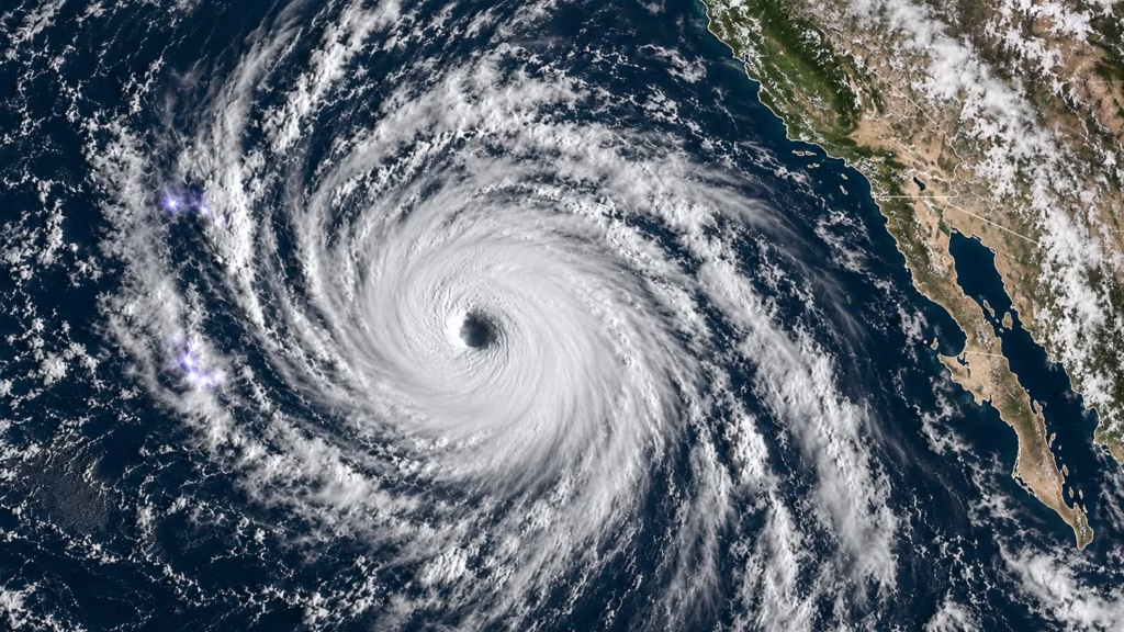
Hurricane Polo became the third Category 5 hurricane of this Pacific season on Tuesday morning, reaching maximum sustained winds of 160 mph roughly 24 hours after it was a 50 mph tropical storm — a wind-speed jump of 110 mph in a single day. By Wednesday, it had eased slightly to a still-major Category 4, with winds near 150 mph, drifting north roughly 165 miles off Zihuatanejo along Mexico’s Pacific coast.
Forecasters at the National Hurricane Center and Mexico’s weather service both expect Polo’s center to remain offshore, sparing the coast a direct hit. But tropical storm conditions, storm surge, and heavy rain — up to 8 inches in Guerrero and Michoacán states — still carry real flash flood and mudslide risk, and Mexican authorities have issued tropical storm warnings from Tecpan de Galeana to Manzanillo.
The number that matters most to climate scientists isn’t the peak category — it’s the 110 mph jump in 24 hours, a phenomenon called rapid intensification. “This is one of the strongest storms ever in the [Pacific] Basin,” said Kristen L. Corbosiero, an atmospheric sciences professor at the University at Albany. Polo’s intensification rate is comparable to Hurricane Otis, which underwent a similarly explosive 105 mph jump in 21 hours in 2023 before devastating Acapulco — and trails only Hurricane Patricia’s 2015 record of 120 mph in 24 hours.
There have only been three prior Eastern/Central Pacific seasons on record with three or more Category 5 hurricanes: 1994, 2002, and 2018. This is now the fourth. Scientists point to unusually warm ocean water, intensified this year by a strong El Niño, as the direct fuel behind storms strengthening this quickly — a pattern that has become measurably more common as ocean temperatures rise.
| WHY THIS MATTERS A storm that stays offshore can still be the year’s most important hurricane story if the rate it intensified at is becoming the new normal rather than the exception — this is the fourth Pacific season on record to produce three-plus Category 5 storms, and three of those four have happened since 2018. |
| SOURCE TRANSPARENCY: NPR, CBS News, CNN, AccuWeather — real-time storm tracking and expert commentary, September 22–23; Yale Climate Connections — rapid intensification analysis and seasonal record context; National Hurricane Center — official advisories and forecast track |