
ONYX flagged September 10 as the Atlantic hurricane season’s statistical peak since August 29 when Tropical Storm Dolly formed. FEMA has been managing simultaneous disaster responses since August. Today the statistical peak arrives with FEMA already in a compressed resource environment.
WHAT THE STATISTICAL PEAK MEANS
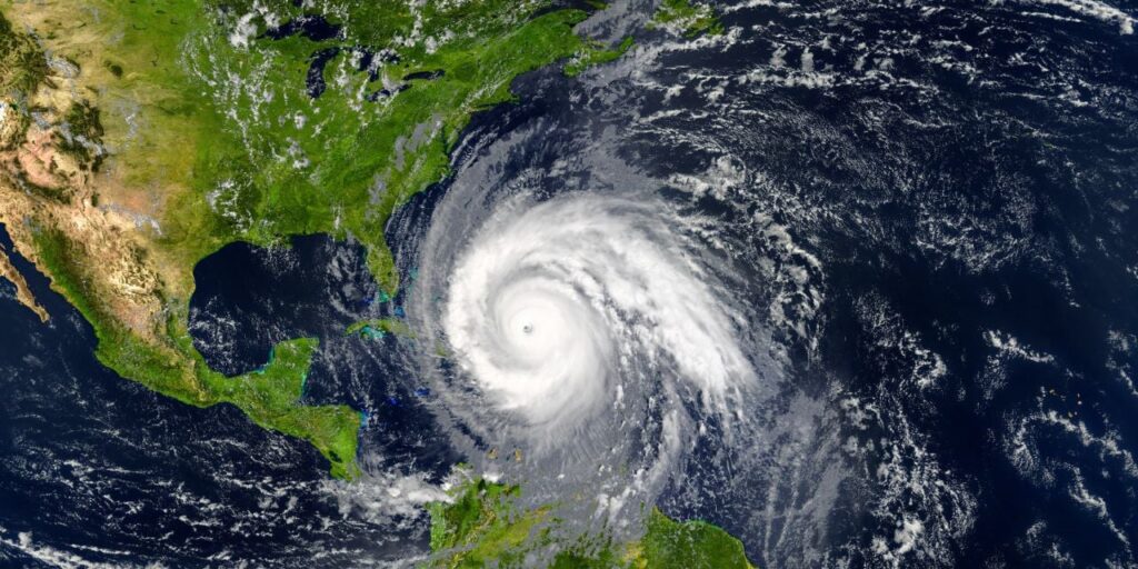
The National Oceanic and Atmospheric Administration documents September 10 as the date around which Atlantic hurricane season activity is most likely to peak, based on the historical record. The specific mechanism: sea surface temperatures in the Atlantic and Gulf of Mexico reach their annual maximum around this date; warm ocean water is the energy source that drives hurricane formation and intensification. Atlantic sea surface temperatures in 2026 are above historical average in several key development zones.
THE ACTIVE SYSTEMS
Current active tropical systems as of September 10, 2026:
▸ Tropical Storm Dolly (Atlantic): formed August 29; has been moving through the Atlantic; current track and intensity from NHC September 10 update
▸ Hurricane Lowell (Pacific): Category 3 that threatened Hawaii September 7-8; current status from NHC
▸ Additional development potential: the peak window extends approximately September 8-14; the highest probability of new named storm formation is in this week
THE FEMA SIMULTANEOUS PICTURE
FEMA’s current disaster management load on September 10, the statistical hurricane season peak:
▸ Indiana flooding — Day 40+ of ongoing recovery
▸ Hawk Fire (Reno, Nevada) — partial containment; monitoring active
▸ Grand Canyon flash flood — September 2; recovery ongoing
▸ Miami crash response — September 7; airport safety investigation support
▸ Hawaii — Lala and Moke damage recovery; Lowell threat response
▸ Detroit tornado — September 6; emergency operations
THE DISASTER RELIEF FUND
ONYX documented the Disaster Relief Fund’s adequacy concerns throughout the arc: August 10, August 22, August 30. The continuing resolution through December 11 funds the DRF at current appropriated levels — a level that was documented as inadequate before September’s disaster load began adding to it. If a major hurricane makes landfall on the US coast on or near September 10, the DRF would face a major federal disaster declaration on top of the multiple active responses it is already supporting.
THE SPECIFIC RISK WINDOW
The highest-risk window for major Atlantic hurricane activity: September 8-17. That window began two days ago. It has nine days remaining. FEMA is at peak simultaneous disaster load at the precise moment the statistical risk for additional major hurricane formation is highest.
Today is the statistical peak. FEMA is managing six simultaneous active disasters. The Disaster Relief Fund was depleted before any of them. The highest-risk window for Atlantic hurricane formation has eight days left. That is the specific disaster resource picture on September 10, 2026.
WHAT HAPPENS NEXT
▸ Dolly track — whether Dolly strengthens and where it tracks toward the US coast
▸ September 10-17 window — whether additional storms form in the peak development zones
▸ FEMA DRF — whether Congress acts on emergency supplemental appropriation
▸ October — the statistical end of the most active hurricane period
| CONFIDENCE: HIGH | September 10 Atlantic hurricane season statistical peak, FEMA simultaneous disaster management, DRF adequacy concerns from ONYX cumulative documentation. Current system status from NHC confirmed reporting. |
SOURCES
▸ NOAA / NHC — Atlantic hurricane season September 10 peak, September 10, 2026
▸ ONYX August 17 – September 10 — FEMA disaster tracking